

GENERAL URBAN PLANNING STUDIES AND SERVICES
A large part of what we offer is bridging the divide between land use attorneys and developers (our primary clients), and the urban planners who review their land use applications. In essence, empowering our clients to speak the same language as the planners, who generally prefer maps and graphics to the written word. Nowhere is this more important than in the context of a proposal, such as a rezoning, that is an exercise in urban planning. In such cases it is essential to present the proposal in the style and vernacular of urban planning, so that the agency planners can champion your proposal as if it were their own.

PLANNING AND ZONING STUDIES
To our minds, what is really happening when we prepare planning and zoning studies is two things.
First, you are conveying a depth of care for the subject matter (land use and zoning) comparable to that of your audience. In other words, you are showing a planner that you undertake the same degree of care in crafting a proposal that they do. And, this depth of analysis shows that you understand that you need to make a case, beyond simply asking for something.
At the same time, you are expressing a degree of empathy in that you understand that ultimately a staff member may have to defend your proposal as though it were their own. And what you are doing is showing them that you will provide support if they adopt your proposal.

HISTORICAL USE RESEARCH
In order to establish the continuity of a nonconforming use, or a nonconforming sign, you will often have to document what has existed on a site for decades. As you likely know, property owners are not the best at maintaining records, let alone photographs and other documentation. That's where we come in. Our staff are well-versed in all of the resources available for researching the history of NYC buildings and properties. We can perform such research at City agencies, on the internet, and at various other places (such as university libraries, and archives). When such research is complete it becomes part of a formal report that you can include with your ZRD1, or other application. The photograph of the building shown here, taken between 1940 and the present, was used to successfully establish the continuity of nonconforming ground floor retail use.

SIGHTLINE STUDIES
There are basically two types of Sightline Studies: one documenting from where new construction can be seen, and the other documenting what can be seen from a particular location. The former most often appears in applications before the Landmarks Preservation Commission. In the example at right, the areas from which a proposed rooftop installation atop a landmarked building would be visible were analyzed by photographing the building from a series of vantage points throughout the subject neighborhood.
A more interesting question we are frequently called upon to investigate is what the view from a particular building will be, and what the chances are they will be blocked by future construction. In such cases we typically model the location of the subject unit, and then undertake a systematic review of the surrounding area to determine the properties that are ripe for new development. Next, we estimate the size and shape of such new developments. Finally, we take the results of our analysis and create a series of maps, diagrams, or augmented photographs that explain how views are likely to be affected by future development.

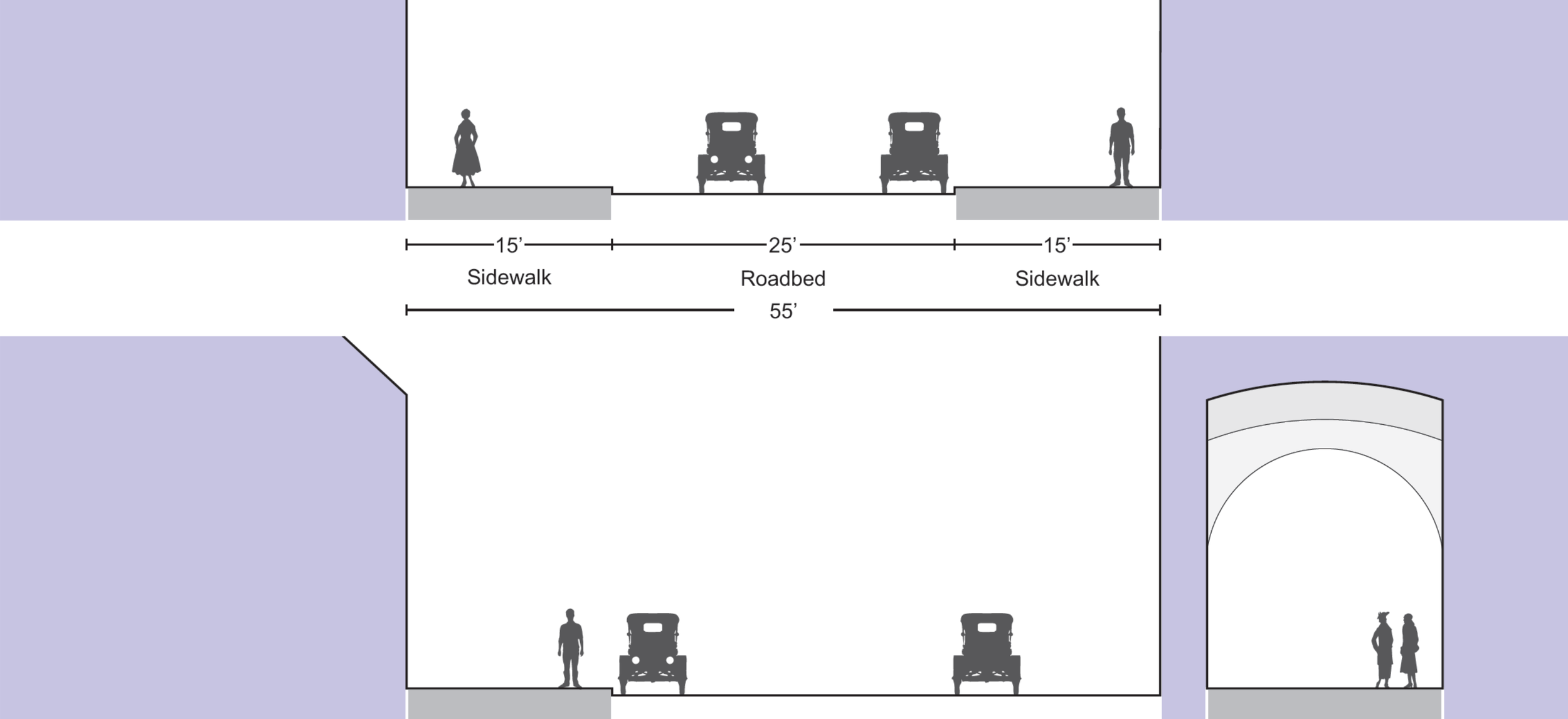
PARKING SURVEYS AND STUDIES
There is nothing special about a parking study. It just needs to get done. And then the results need to be documented. It's typical that our work (be it photographs or a land use survey) will take us to the site anyway; so why not have us perform the parking survey while we are there? What's more, since we are presumably already preparing other maps for the application, it makes sense to have us prepare one more: showing the results of the survey. Such surveys typically include not only the number of cars parked, but also the number of on-street spaces believed to exist (in total), the location of off-street parking facilities (and their capacity), and the nature of on-street parking regulations.

PLANNING POLICY RESEARCH
An effective way of advocating for your project is to argue that it is consistent with the City's land use planning and policy. Unfortunately, in New York such plans and policies are not set forth in a single Comprehensive Plan (as in other jurisdictions), but rather are the perpetual synthesis of land use and planning studies, reports, and decisions by the City Planning Commission and the City Council. It follows that determining just what the City's plans and policies are takes a good deal of research. That's where we come in. Our office offers, as a service, to research recent actions, reports, and studies in the area surrounding your project, or which are relevant to your project. The results of that research are presented in a written report, or a series of maps and graphics.

BUSINESS AND EMPLOYMENT STUDIES
When zoning changes reduce the amount of area that is zoned for commercial or manufacturing use, one concern that is often raised is that the change will result in the loss of jobs or businesses to the City's economy. At the scale of the neighborhood, or even the scale of the block, the best (if not the only) way of quantifying such impacts is to perform a business and employment survey. This product is exactly what is sounds like: We visit the area in question, recording the number and type of businesses in each building, and knocking on doors and speaking to staff to determine how many people are employed at each location (at least so far as respondents are willing to share that information). The results of our survey are compiled in a presentation that include maps, photographs, and the pertinent data.

CHARACTER-DESTINATION STUDIES
Beyond land uses, generally, there is often the question of whether or not the neighborhood infrastructure exists to support a proposed development, For example, even if there is generally support for rezoning a portion of a manufacturing district to allow for residential use, do the necessary supporting services (from public schools to convenience stores, to transit options) exist? Our neighborhood destination studies are squarely focused on this question. They typically identify certain classes of use (retail, community facilities, transportation) within an extending radius (i.e. quarter-mile) from a project site.

DRONE PHOTOGRAPHY
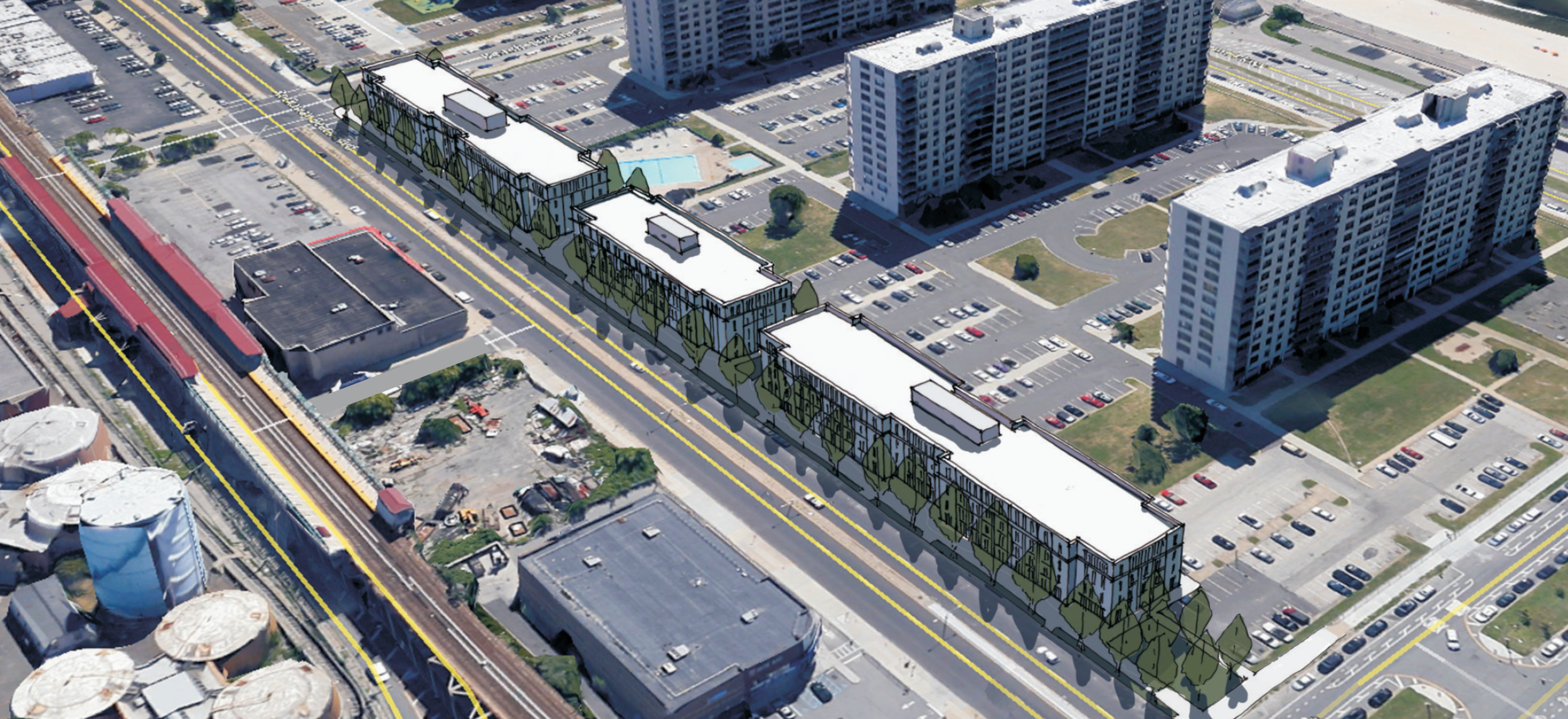
In the past few years, custom aerial photographs—once only possible by airplane or helicopter at a cost in the thousands of dollars—have been made accessible using drones. To be fair, for most projects drone photographs are overkill. But in certain cases, they are invaluable. For example, large scale developments, larger sites without internal paths, undeveloped sites consumed by woods or vegetation, or in cases where you seek to illustrate the relative height of the surrounding buildings.

BUILDING/ARCHITECTURAL SURVEYS
There are a number of dimensions along which neighborhood character can be measured: land use, height, floor area, etc. While all of those are useful, sometimes a more particular approach is necessary; one that considers the actual themes of design that characterize a place. With that in mind, our architectural and building surveys offer a fine-grained approach to establishing neighborhood character (or appropriateness, in the context of Landmarks' work) that focuses on the architectural elements and details that define the character of a place.

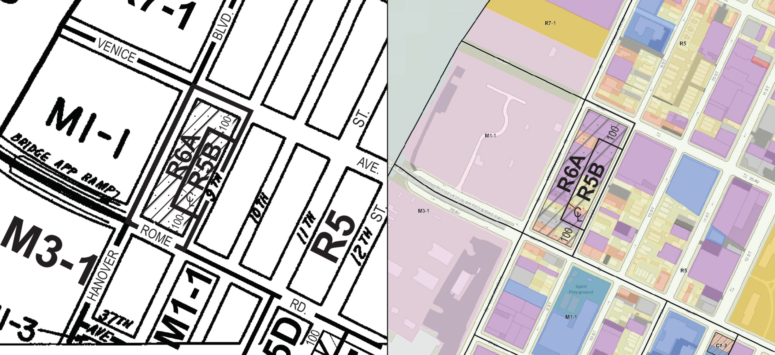
SANBORN MAPS
You may be thinking: Anyone can order Sanborn Maps; how is that an Urban Cartographics product? If you simply want the maps, we agree. But why stop there? The maps can be customized in any number of ways: from simply identifying your site, to identifying particular uses, or particular building types in the area surrounding your site over time.