
ADVANCED ZONING ANALYSIS
Why prepare a zoning analysis without graphics? Sure, it's done all the time; in the form of zoning opinions, and memorandums. Or in the form of analyses by code consultants and architect who use little (if any) visuals to explain how zoning applies. To our minds, such analyses leave much to be desired since they effectively ignore the old adage that a picture is worth a thousand words.
That you may not personally have the capacity to produce graphics doesn't mean your next zoning analysis shouldn't include them. To be sure, compelling illustrations take zoning analyses to the next level; from good to great. And whether we perform the analysis, or simply illustrate your findings, your next zoning analysis should include them.

MASSING STUDIES
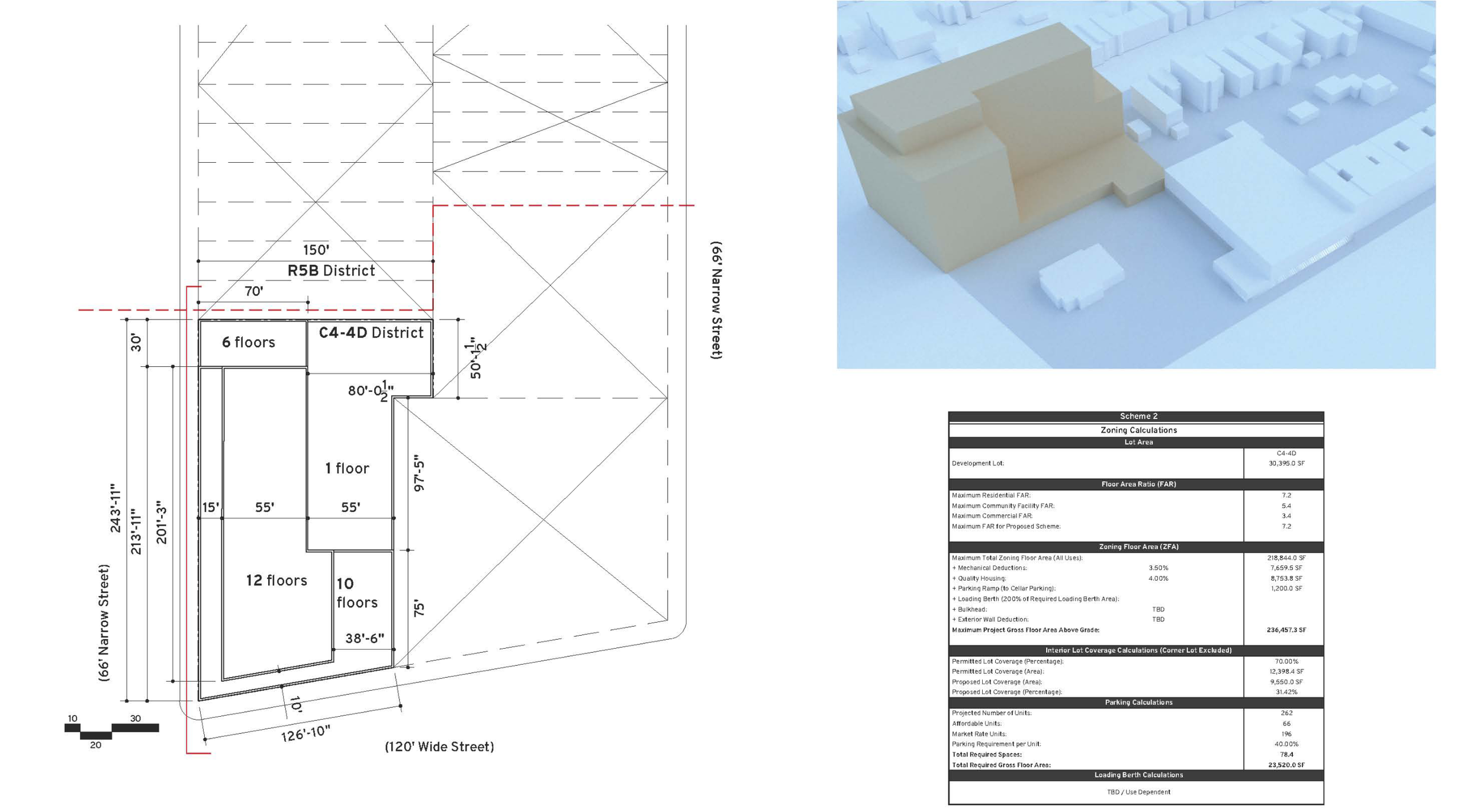
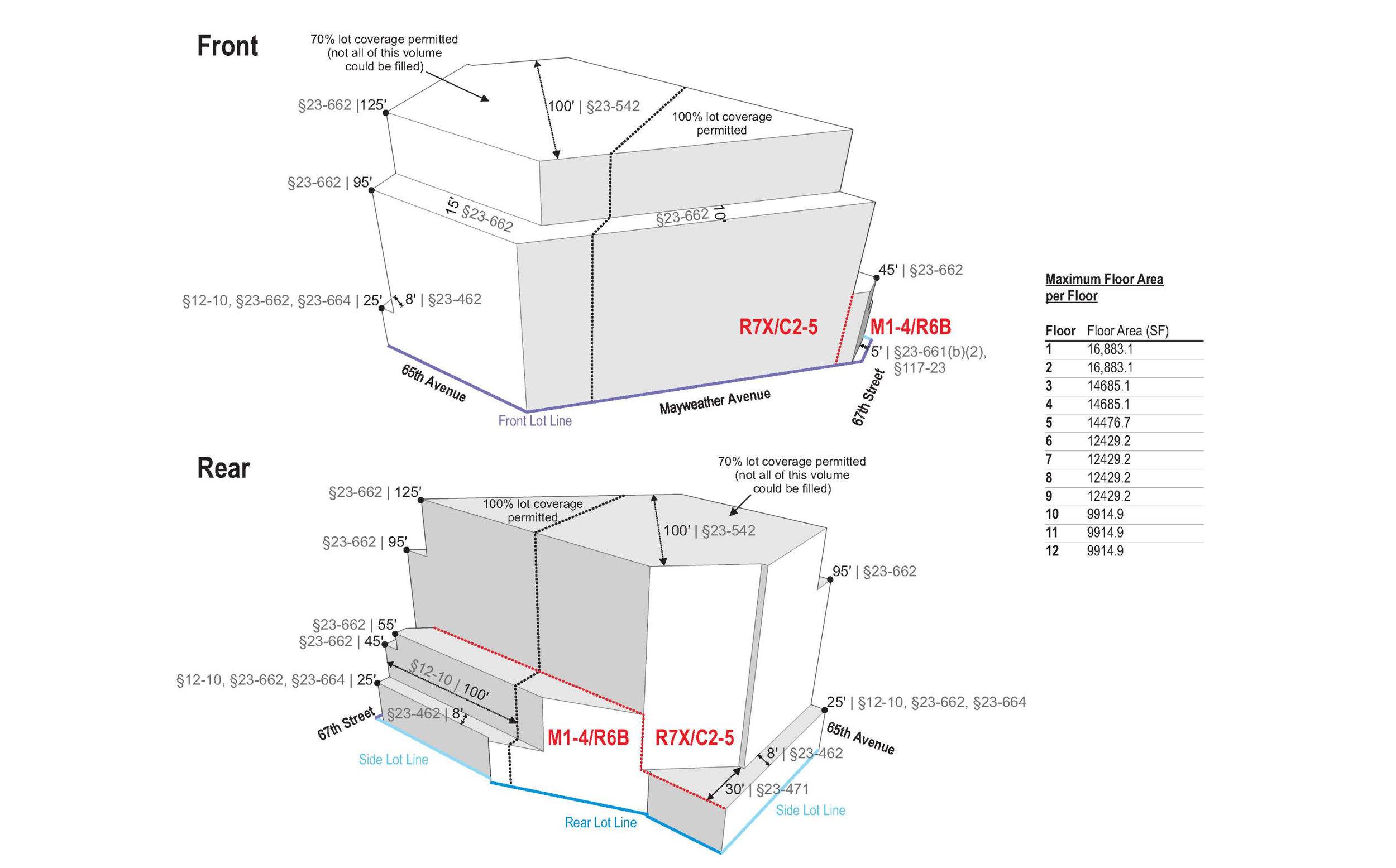
The most basic type of zoning analysis we prepare is a massing model. This is simply a three-dimensional model of the applicable bulk regulations, along with corresponding figures (floor area, FAR, height, etc.).

DEVELOPMENT RIGHTS ANALYSES
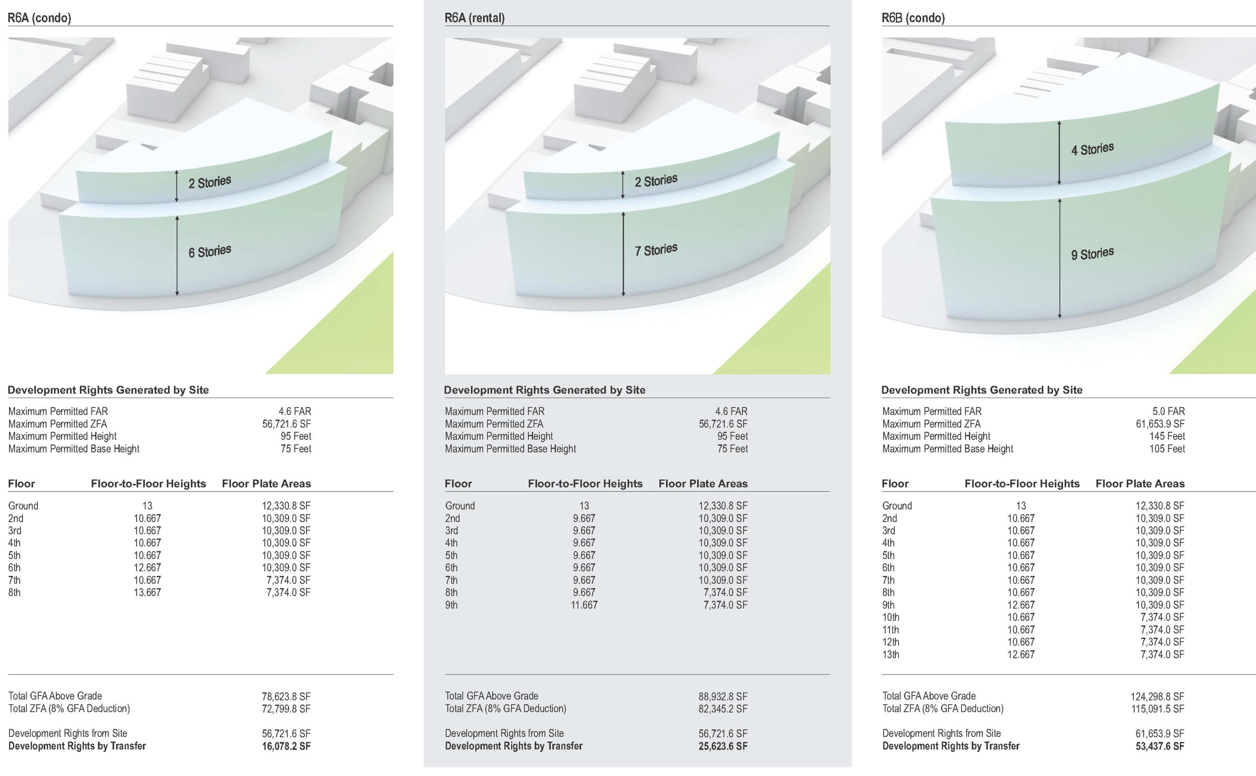
One context in which zoning analysis proves exceptionally valuable is in the scenario planning that surrounds transfers of development rights. For example, what can be developed on the site alone? What if the site is merged with the adjacent lot, or two lots, or three? What if existing buildings remain, and what if they are cleared to make way for the new development?
COMPLETE ZONING ANALYSIS
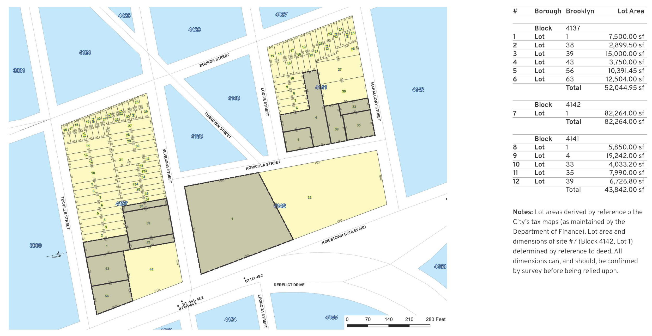
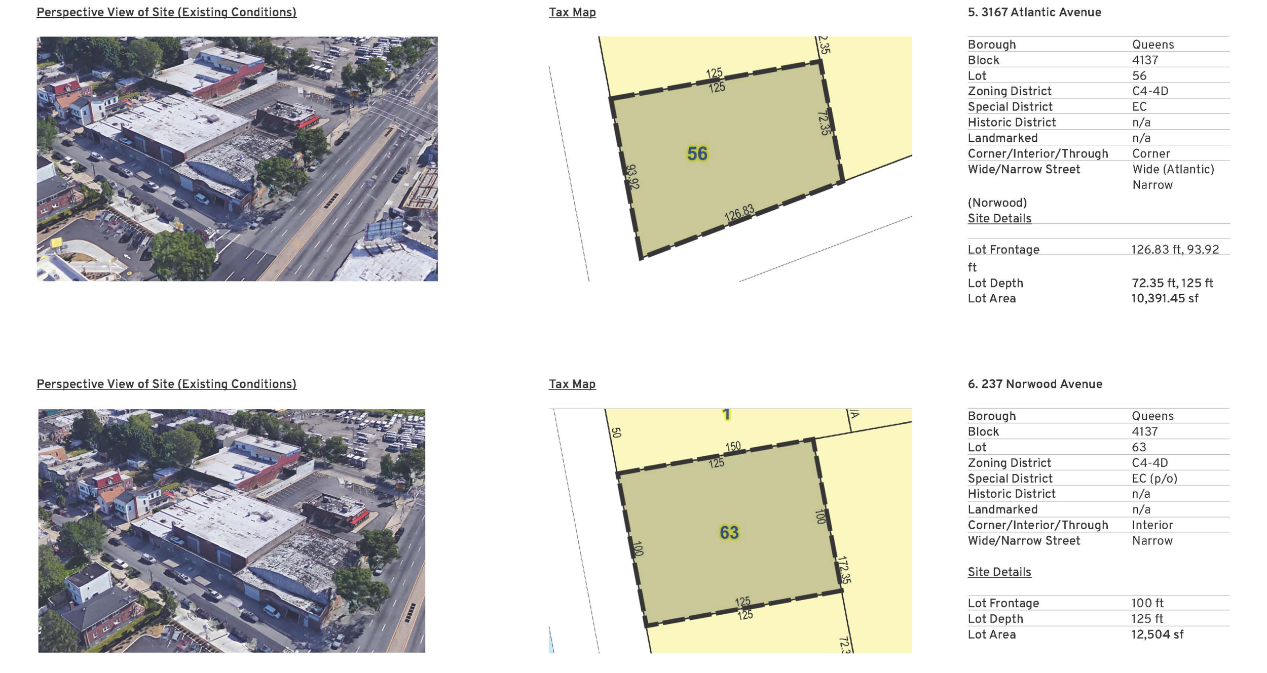
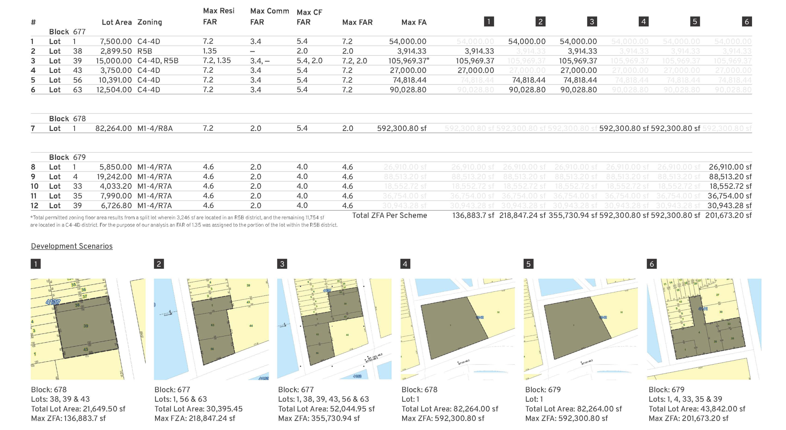
Zoning analysis is an essential step in development planning, from the very earliest stages. The most advanced form of zoning analysis we offer begins with little more than potential sites, and asks the fundamental question: what can be done? In the examples shown below, we were tasked with analyzing potential development options for 12 properties owned by a single institution, across three tax blocks. In this case, unlike most, the owner did not arrive at the inquiry with any preconceived notion of what could, or should be developed on the sites. In fact, whether the sites should be developed as 3, 4 or 5 assemblages was undecided.
Next, working with our partner Red Flux Architecture (who are highly recommended) we developed site plans, schematic drawings, and three-dimensional models for six potential developments; five mixed use (residential–commercial) developments, depending on how the several sites were assembled; and an alternative commercial development for one of the sites (that was in a different zoning district than the others). All of the same were presented, alongside our zoning calculations, in a detailed report.